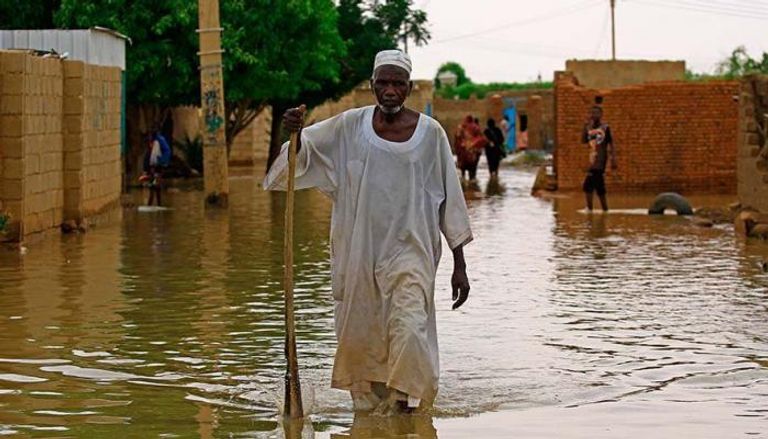
Several Sudanese states are facing dire humanitarian and environmental conditions following a new wave of floods that swept across the country in recent weeks.
Torrential rains and rising river levels have submerged vast areas of farmland and residential neighborhoods, causing major human and material losses.
Reasons of Sudan Floods
The Sudanese Ministry of Agriculture and Irrigation announced that this year’s rainfall was highly unusual, with the autumn season delayed and extending until late October.
This climatic shift led to increased water inflows from the Ethiopian Plateau, the main source of the Blue Nile and Atbara River.
The ministry added that rainfall levels were significantly above average, directly affecting the Nile’s water levels.
The White Nile alone recorded an increase in water inflow ranging between 60% and 100% compared to the average since 2020, while the Atbara River registered its highest level in years.
The Role of Grand Ethiopian Renaissance Dam (GERD)
Regarding Grand Ethiopian Renaissance Dam (GERD), the ministry explained that the dam’s reservoir was recently filled and water releases began on September 10.
Although the maximum daily discharge of 750 million cubic meters was lower than in peak flood seasons of previous years, its timing coincided with Sudan floods, significantly raising river levels across Sudan.
Emergency Response and Monitoring Measures
In response, the Sudanese government formed an emergency task force led by Agriculture and Irrigation Minister Ismat Qureshi.
The task force includes senior water and dam officials as well as early-warning and monitoring teams.
The ministry emphasized that reaching flood levels at monitoring stations does not necessarily mean villages or farmland will be submerged but urged citizens to remain calm while strengthening preventive measures.
It also noted that Blue Nile inflows have already started to decline and water levels are expected to gradually decrease in the coming days.
Agricultural and Infrastructure Losses
In Al-Jazira State, 1,764 acres of farmland across 176 farms—benefiting over 238 farmers—were destroyed by Blue Nile floods.
The losses included vegetable crops and fruit orchards such as mangoes, citrus, and bananas, dealing a heavy blow to the local agricultural economy.
In River Nile State, floods caused partial housing collapses and submerged vast agricultural areas, while also washing away sections of the national highway between Nawa and Dongola, isolating entire villages.
Other areas such as Bedin Island, Merowe, and Tuti also faced the threat of flooding.

Urgent Measures in Sennar and Jebel Aulia
Jebel Aulia Emergency Committee issued an urgent appeal after White Nile waters broke through barriers in several areas—including Al-Assal, Tayba Al-Hasanab, and Al-Kalaklat—flooding residential neighborhoods and threatening homes with collapse.
In Sennar State, the director of Sennar Dam announced partial drainage operations to prevent low-lying areas from flooding.
He stressed that dam management is following the Ministry of Irrigation’s warnings, but acknowledged that the operation of the GERD has created new challenges due to a lack of data on its water discharges.
This forced Sudan to rely on its internal monitoring stations to track developments once the waters enter its territory.


